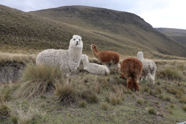
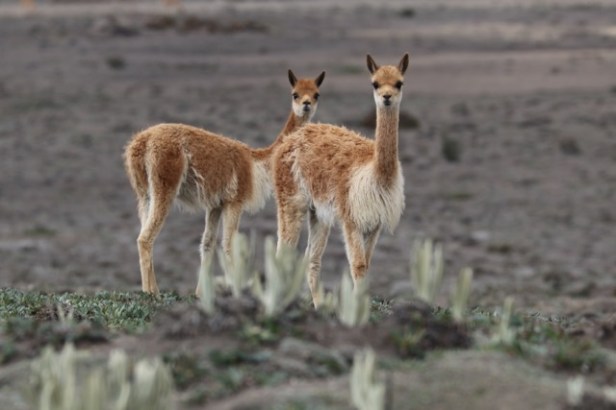
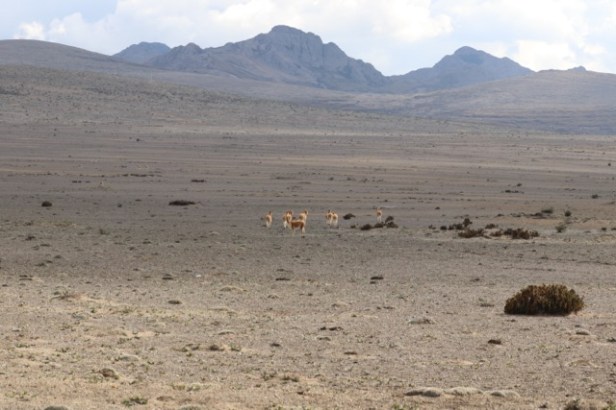
Volcanoes dominated this heavily settled valley with its rich soils and patchwork of agriculture. Mount Chimborazo is Ecuador’s highest peak (at 6310m). This mountain is the nearest point on earth to the sun apparently due to the bulge in the shape of the planet at the equator. As we ascended to a refuge by car we saw a succession of creatures firstly llamas and alpacas, then vicuna further up the mountain as the vegetation diminished in scale.
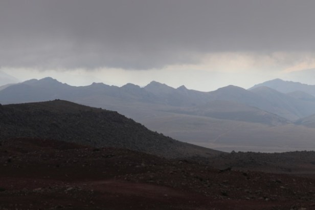
We looked out for Andean foxes, rabbits and condors but had no luck. The refuge was situated at 4800m. We walked up to a memorial for climbers from the refuge as a number of European mountaineers had perished on the peak. It was a big effort and our highest elevation attained on this holiday – 4850m. It also started snowing.
It was a fabulous drive with an excellent road to the National Park entrance. A winding dirt road up to the refuge followed with a marked trail nearby where people could mountain bike down. That would be an amazing thing to do and perhaps an opportunity to see an Andean fox with their big fluffy ears. You can take short walks in national parks, but a guide is needed for longer walks. Authorities take their regulation seriously and people are required to register on entry, though entry is free. Conditions are highly changeable so appropriate.
We also went to the world’s highest train station at the base of Mount Chimborazo and co-incided by chance with a scheduled tourist train. A old fellow at the museum explained he walked up the lower slopes of the mountain 2 times a week with his donkey to dig out 30kg blocks of ice from 1m underground and bring it back down for ice cream making.
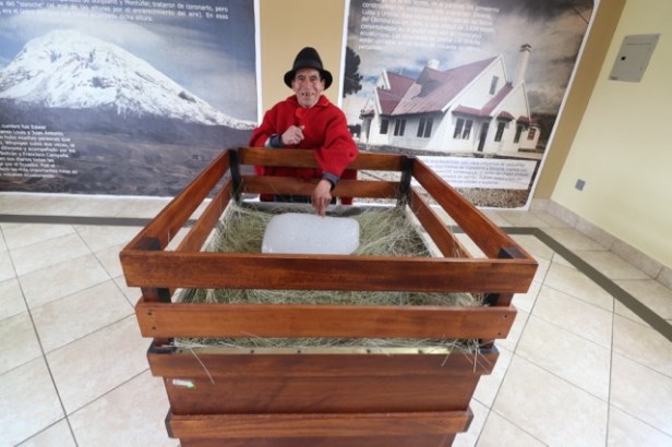
There is a glacier on Mount Chimbarazo but he was sourcing his ice well below the level of the glacier. It was a big effort.
Banos followed which was the adventure sports capital. There was a zipline where you could hang upside down with your feet in a separate harness behind you so you went over a canyon face first, a zipline ending in a cave, you could be suspended in a metal ball frame over a canyon, there was a variety of frightening looking low tech funicular options, bungee jumping, bungee swinging, the Nepalese bridge experience complete with missing wooden slats over a canyon and heaps of other options.
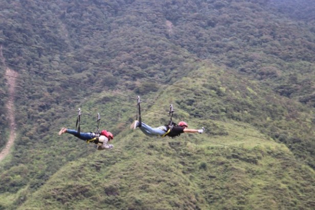 People were embracing the Christmas spirit dressing in Santa and reindeer outfits to go ziplining. It was a fun place.
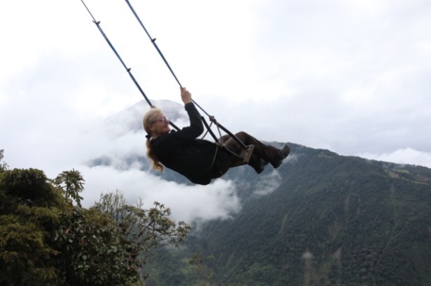
My best effort was going on a big swing over a drop from a volcano viewing platform, that gave a great view of previous lava flows. I could have done without the enthusiastic large European male helper that kept pushing my swing while Steve took ages trying to find the best angle for a photo. I wanted off.
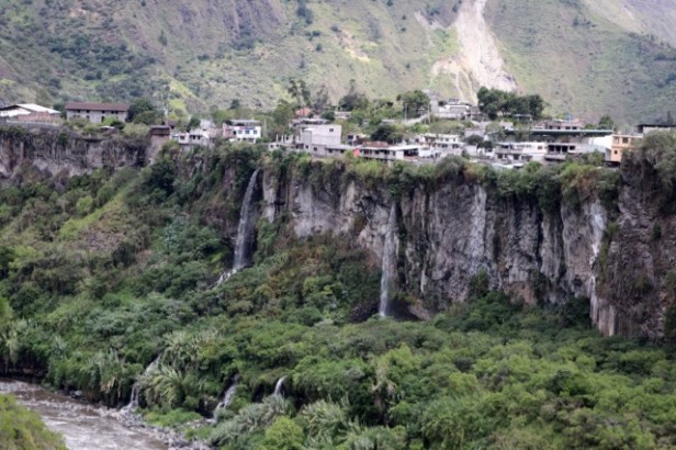
The volcano had only erupted a couple of months previously with plumes of gas and debris visible shooting up from the cone during the day and lava visible at night. The town had a volcano warning system where an alarm sounds and everyone had 20 minutes to get across a bridge. There was a spectacular canyon through the town.
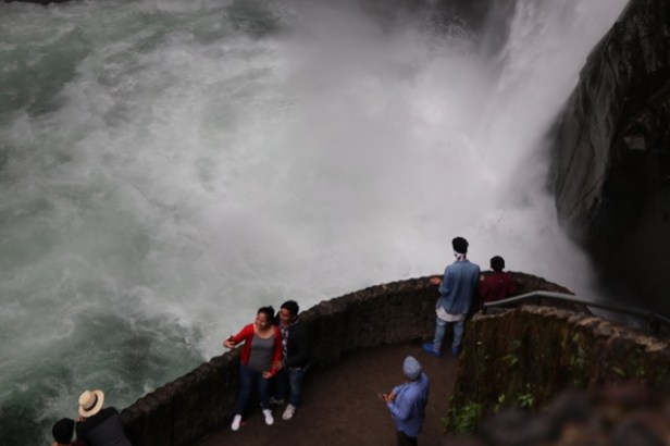
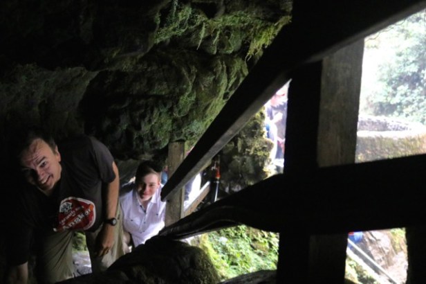
We also visited lots of waterfalls including an awesome one where you walked down into the valley then ascended to viewing platforms adjacent to the waterfall. You could crawl up through very low passages to walk behind the waterfall (and get saturated – Sam did this) near the top. I crawled along thinking it was the way out. No, we had to go right back the way we had come and walk up a long way. It was fun but a bit freaky crawling through narrow spaces with one hand as I was carrying a camera and lens. The lads thought it was great.
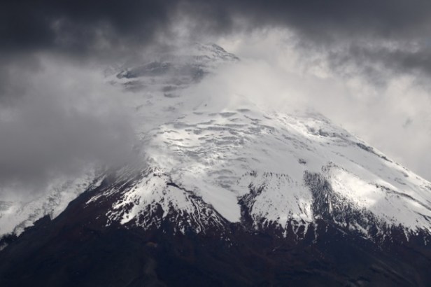
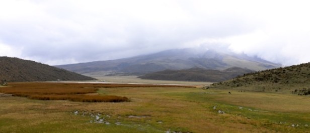
Mount Cotopaxi was our next destination. This is the highest active volcano in the world situated in a large national park containing three volcanoes. As a warm-up, we drove past church remains from a Cotopaxi explosion about 40 km from the mountain from 1871. The eruption had only left the upper part of the church visible and was the last big eruption. Our driver said material was found in Argentina from that event!
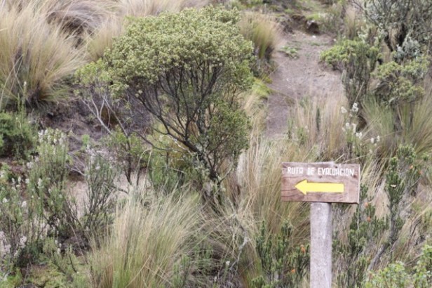
We saw postcards from October 2015 at the hacienda where we stayed showing plumes of material coming out of the cone. We noted the array of signage about evacuation routes visible on the roads and points of interest. Moving to high ground seemed the basic premise.
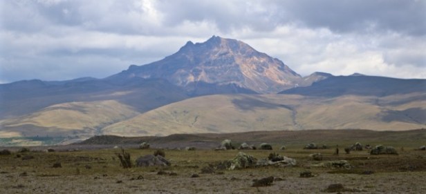
Huge flows of material from lava, pumice and rivers of debris from previous eruptions were visible in the landscape. It was a spectacular area.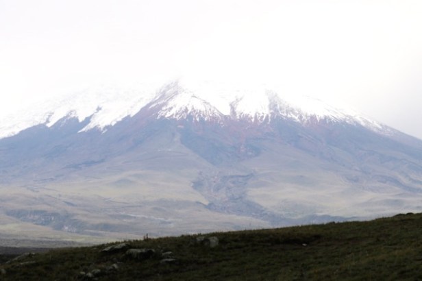
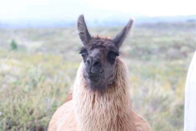
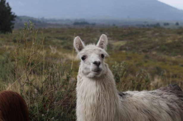
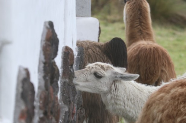
The hacienda where we stayed was at 3600m. It was an attractive place with large windows looking over the extraordinary landscape. Just before nightfall, a group of llamas walked right past our window. Several stopped and peered in our window and you could really appreciate their shaggy bulk and gentle faces. They then took an interest in the stonework at the base of the adjacent building. They seemed to lick the rocks ?? for minerals, water or catching insects or something and then moved on. They are very attractive animals.
We visited a lake which was used by lots of migratory birds and managed some walks, cycling with mountain bikes for the fellas (I didn’t have enough puff) and saw more llamas.
It was our last foray in the natural world before the big city lights of Quito.

The scenery looks fantastic! Your blogs tell us all. Keep it up Marian.
LikeLike
Wonderful natural countryside,you were marvellously adventurous on that swing Marian!Love those Llamas.
LikeLike