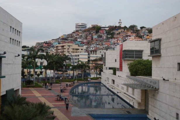
Guayaquil is a vibrant port city, the largest in Ecuador, near the mouth of a large river. It has been the traditional economic powerhouse of the country with Quito the political capital. The charming ‘Malecon’ along the riverfront was a highlight. It was a 2km civic precinct like Southbank (without the beach) with a range of entertainments – restaurants, sideshows, a huge ferris wheel, children’s play equipment, exhibition spaces, memorials, big Christmas displays etc. An elegant walkway meandered through the site and moved between ground and first floor levels with car parking, a major cinema complex and food court on the lower level. In the pleasant and breezy evenings, the area was thronging with locals, especially couples and families. Everyone was out and about unlike during the steamy days.
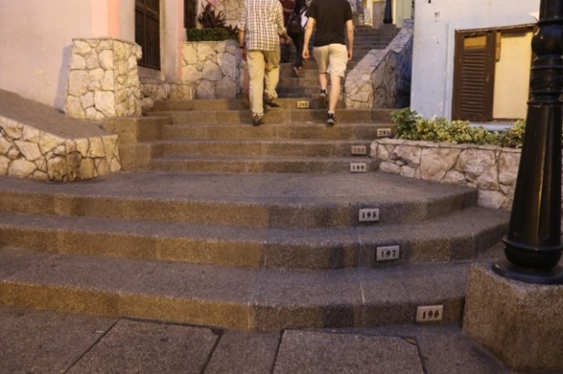
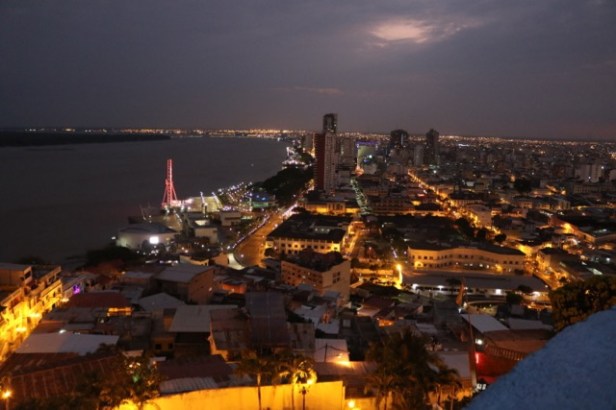
An adjacent hill precinct Les Penas had many artists studios, bars and restaurants on its winding pedestrianized streets. We took a hill climb up stairs numbered to 440 to an old lighthouse with spectacular views of the city. The area and the Malecon used to have a seedy reputation. Now after significant public investment and security tactics (like locking some gardens off at night and security guards with bullet-proof vests!) the area felt very safe and relaxing.
Security is an ongoing issue for Ecuador with Columbia to the north and Peru, an emerging drug source to the east and south. We passed through several police check points on the major roads we travelled on. We saw no specific incidents but there were billboards to be seen at times about drug crime and gangs.
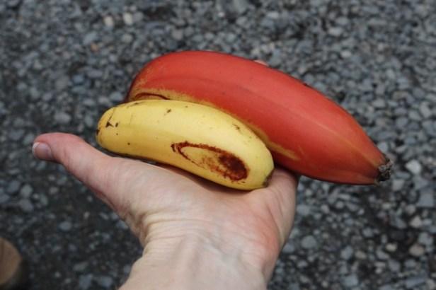
En-route to the highlands, mangoes were in season (green and red) so we purchased an enormous bag and also gave 2 of Ecuador’s 5 banana types a try – including a red one. The red banana was delicious though the small one was very dense and yellower than ours. They would be awesome in smoothies.
Our left-over mangoes met a nice ending as we had several with a few bruises. We stayed at an eco lodge where they volunteered to work around these and juice them. We also drove past a group of birds in a roadside drain that included a half dozen light pink spoonbills (like a lightly tinted version of flamingoes). Fortunately James saw them too otherwise my fellow travellers may have been unconvinced. We didn’t see them again.
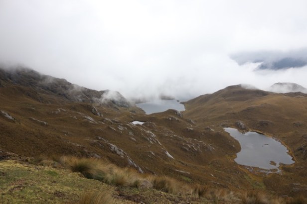
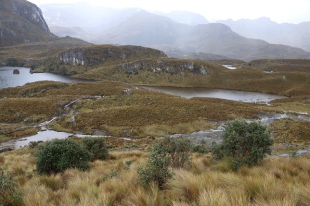
Heading inland to Cuenca up in the Andes, altitude was all-important. We entered thick cloud from about 500m that lasted for ages and made driving conditions difficult before we emerged to clearer conditions above. We drove through Cajas National Park with our highest point being a 4100m pass where we slowly climbed stairs to a viewpoint. The landscape was spectacular with rugged peaks, low vegetation and beautiful glacial lakes visible in every direction (over 700 lakes in the park).
Cuenca has a world heritage listed town centre with two major cathedrals and lots of renovation work underway.
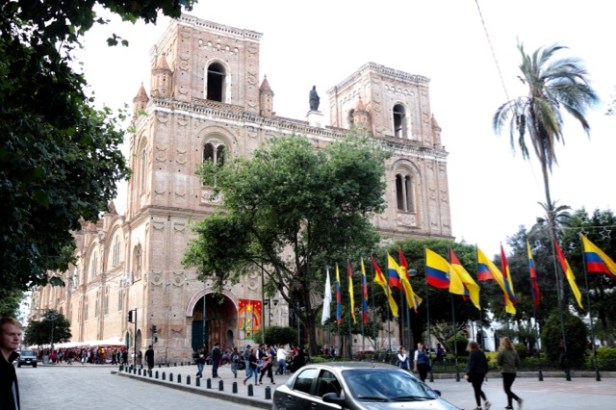
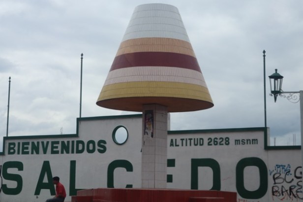
As a Spanish colonial town, it has attractive squares and narrow streets, making traffic flow snail paced at times. Building exteriors were generally fairly austere, often two storey stucco, with red tiled roofs and more splendid and ornate interiors. The opulence of the internal fitout of buildings and stores we visited was surprising reflecting an interest in style with ‘Cuenca fashion’ a phenomenon. There were stylish hat shops here too with many types made from the reeds of local lakes. Panama hats were the local staple as they are actually hats that were made originally in Cuenca and used by workers on the Panama Canal construction (Cuenca hats didn’t have the same ring to it I guess). There was great local expertise in hat-making.
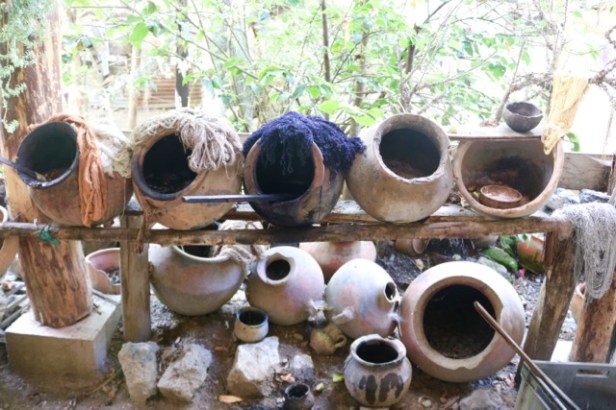
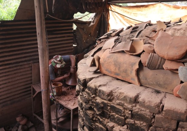
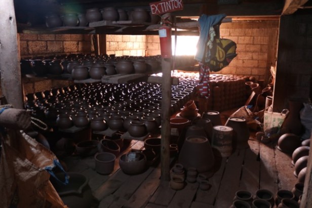
We visited a range of small towns nearby that had also developed specialist crafts. A jewellery making town had its town square dominated by at least 20 jewellery stores, with amazing filigree work in both gold and silver from local mines. We visited a town where dyeing and weaving cloth dominated and a town where potting was a speciality (with very good clay available locally). The potter we saw made a half dozen pots in a few minutes.
Some more recent examples of towns that had embraced particular expertise was a place of denim jeans manufacturing (the main street was totally dominated by jeans stores of all [quite fashionable] different styles) and ice creams (had a statue of an ice cream and lots of operators gesturing punters into the myriad ice cream stores).
Our driver was great taking us to small enterprises where we could see craftsman at work. At one place I bought a scarf after seeing the laborious weaving and natural dyeing process but there was no pressure to buy the wares.
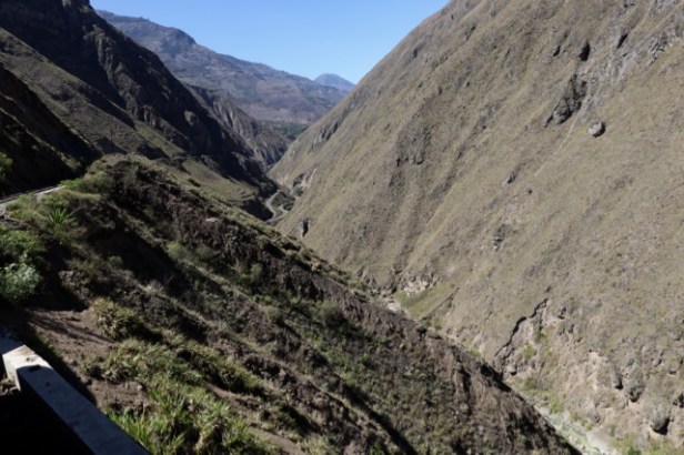
We followed the circuitous Panamerican Highway for much of our route descending into valleys and winding around mountains. Driving late in the day, we often drove through cloud. Fortunately, the roads were always excellent except in remote areas when the roads tended to be cobbled stones.
Ingaperca was an interesting Incan town, not of the scale of sites in Peru like Macchu Pichu but atmospheric with a hillside setting with grazing llamas. Having been built on the site of a previous settlement, the Incans dominated here by stealth rather than violence.
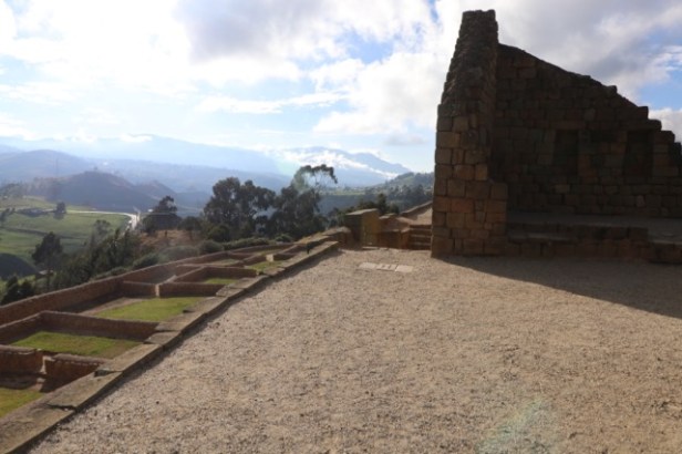
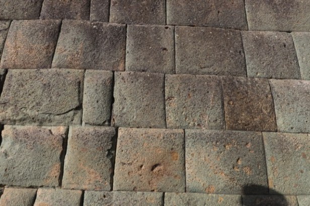
They used interesting technologies communicating by mirrors and fire from their hilltop location. They also used runners when needed along the Incan road with changeover points every 12 kilometres. This pebbly Incan road through Ingaperca ran to Cusco a couple of thousand kilometres to the south (and also extended north into Columbia). Precision cutting of blockwork without the use of mortar featured in the single Incan building remaining on the site.
The Incans worshipped the sun and made precise construction based on observations of the sun. Niches were built into the buildings reflecting the equinoxes for the position of the sun (we visited on Dec 22 near sunset and it looked right to us). These observations were used to tell people when to plant and harvest and they used precise astronomical observations and rock markings on the site showing the length of the moon cycle and giving their year of 13, 28 day months. Most of the building stone had been taken away from the site over time and used in local buildings. They had been given a large number of returned blocks (what a puzzle) but much work remains to be undertaken on the site, which was only partly excavated.
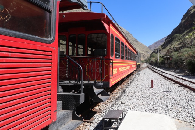
Alausi was the starting point for the Le Nariz del Diablo (the nose of the devil) train trip run by Tren Ecuador. It was a zig zag railway descending down this feature to provide a link from Quito to Guayaquil in earlier times. A large number of imported Jamaican and local workers died in the project particularly from the explosions for the cuttings. Construction also scared away the Condors who used to nest on the mountain – they have never returned (the indigenous name for the same mountain means Condor place).
There were local dancers performing down at the lower station and a small museum, market and café so it had a carnival air. We were given small woven Christmas decorations from Tren Ecuador and had our photo taken (maybe we’ll feature in publicity brochures in the future!). Tren Ecuador has invested significant resources in recent years to redevelop sections of their spectacular rail network to provide a range of tourist trains.

You all seem to be getting the most out of your tour!
Is that the boys on the zip Line? Google Earth is amazing following your path through the Andes.
Cheers, Petes
LikeLike
Feel as if I’ve been there, towns look very interesting….don’t know about those steps though!!!!
LikeLike