")
National Geographic images of honeycomb geology come to mind when thinking about the Bungles Bungles for good reason. They were only ‘discovered’ in 1983, by a journalist contacted by a cattle ringer from Kununurra who flew helicopters. They were then subject to a burst of publicity at that time and have been subsequently protected with World Heritage listing.
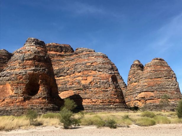
The Domes 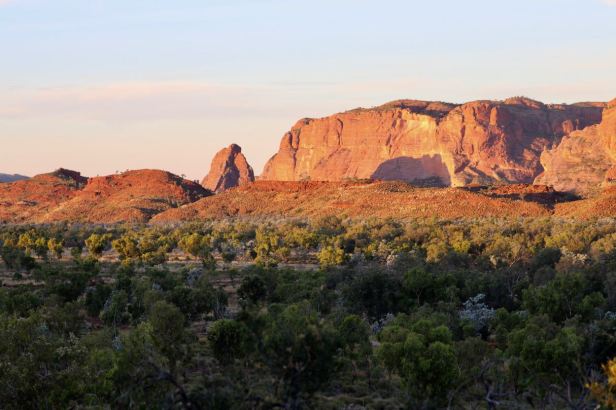
Northern end from Kurrajong
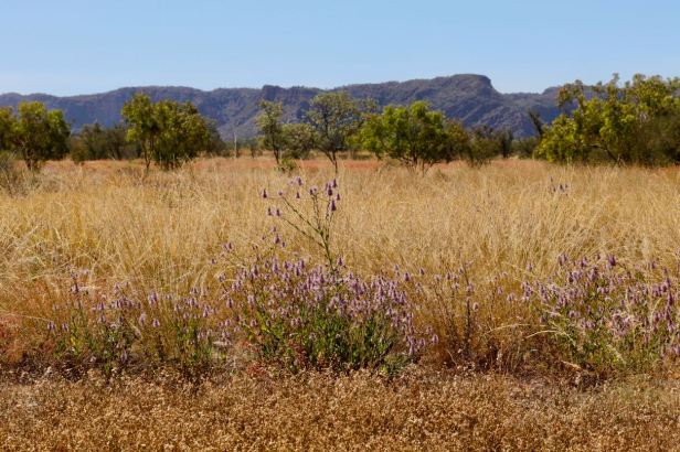
The name is thought to be a misnomer and the present name is Purnululu. Bungle bungle is in all likelihood the tufty grass that is everywhere in the park;
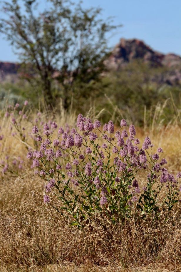
Grass clumps like formal landscaping
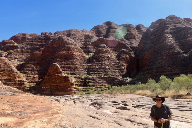
The massif is an extraordinary outcrop at the edge of the Tanami Desert. The forms of Pernalulu are the familiar beehives at the southern end and soaring cliffs at the northern end. The landform is the largest example of this particular form of karst sandstone weathering in the world.
Southern Formation 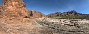
Piccaninny Creek
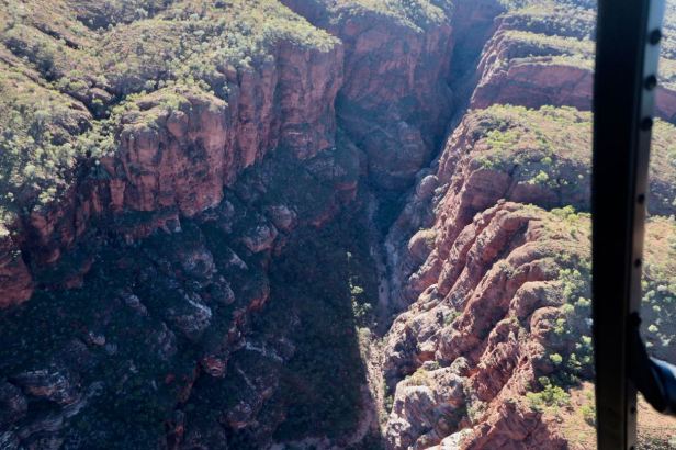
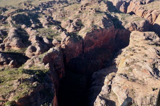
The landform initially had a regular pattern of rectangular fractures that have then eroded to form the beehive outcrops of the southern end and a series of gorges slicing into the sandstone throughout the formation. The colouration is extraordinary with the red band being oxidised sandstone and black banding being algae on the harder interspersed layers from successive deposition when the rock was formed. Where the surface breaks away the white sandstone underneath is visible and there is stunning white sand in many of the creek beds just like Fraser Island. Many of the creek beds are scoured back to rock.
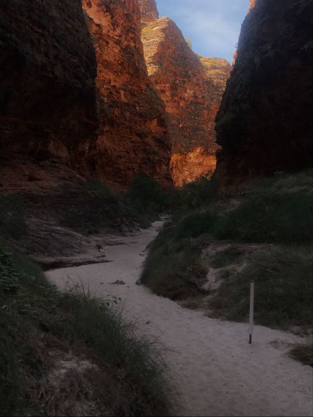
White sand creek bed 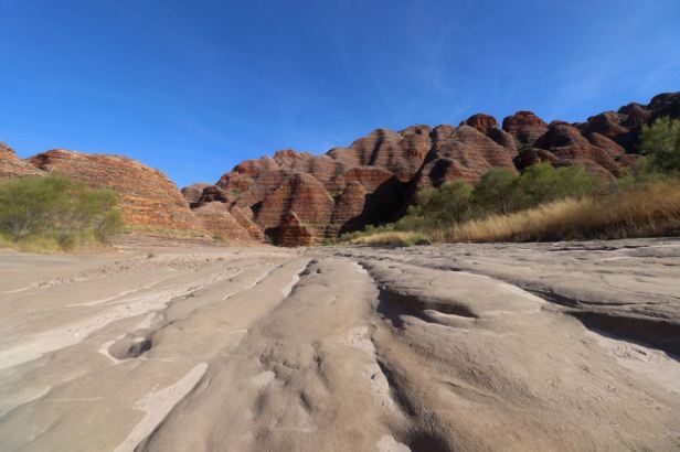
Piccaninny Creek
It is quite hard to comprehend the wet seasons as a visitor in the benign cool dry season to Purnululu. The creek beds give a clue to the potential height and volume of water which must be present sometimes during the wet season. Purnululu abuts the desert so would receive less rain than the Kimberleys to the north, but the action of water on this ancient landscape is very evident. Apparently this year’s wet season 2021 was a good one. In the dry season, the waters generally evaporate until the next season.
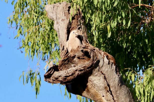
The campgrounds available within the NP offer somewhat different experiences. The northern site Kurrajong is open country and a series of sites adjacent to a small dry creek bed. The area is dominated by a flock of noisy little corellas. These birds are an audio backdrop to everything calling out for all members of the group to know each others roosting sites and movements during the day. There are nesting sites and squabbles and there is ongoing activity especially in the early evening and mornings. There is also a walk and lovely sunset lookout behind the campground.
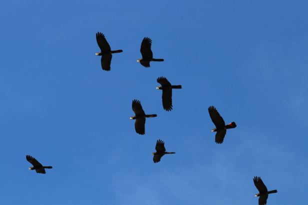
Black Cockatoos 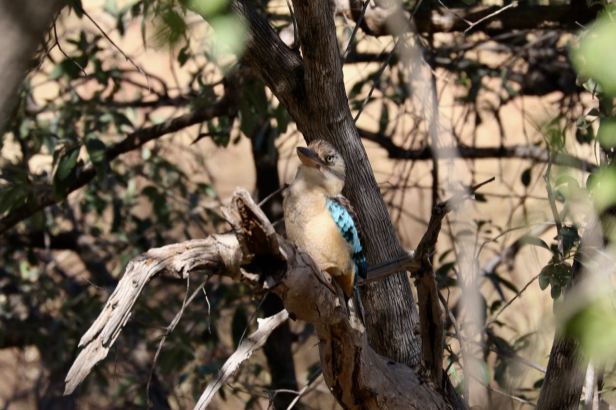
Blue winged kookaburra moments after gulping down a very sizable lizard
The southern campsite Walardi is more treed and situated on the bank of a wide dry creekbed with fewer campsites and an array of birdlife. Eucalypts dominate the campground with at least two pairs of whistling kites nesting in the tallest trees and many other birds active in the area. The noisier occupants are little friarbirds, great bower birds, a pair of little corellas, a sulphur crested cockatoo and some red tailed black cockatoos but the overall effect is much more peaceful. There were lots of different honeyeaters and other birds and even some brown quails cheeping away near our site. There is a local walk that follows this creekbed and a narrow tributary.
Little Corella Walardi 
There are several spectacular walks at the Bungle Bungles. They are not overly long but some are quite arduous. There can be lots of rocks to climb over and creek bed routes can range from sinking pebbles, to soft sand and bedrock. The routes are often quite exposed too so they require some effort. An early start is the best option.
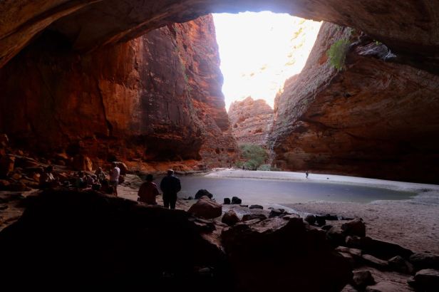
Cathedral Cave 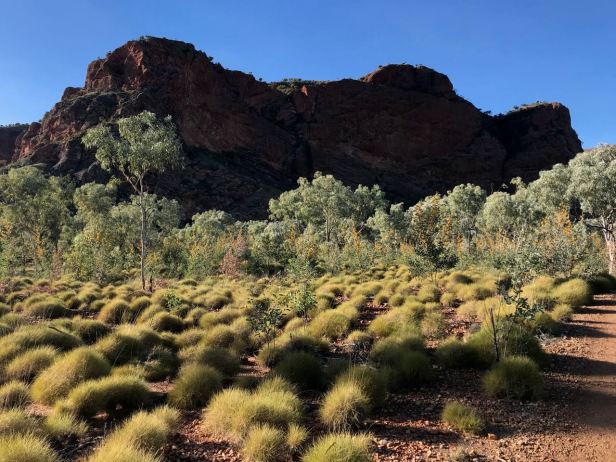
Homestead wallk
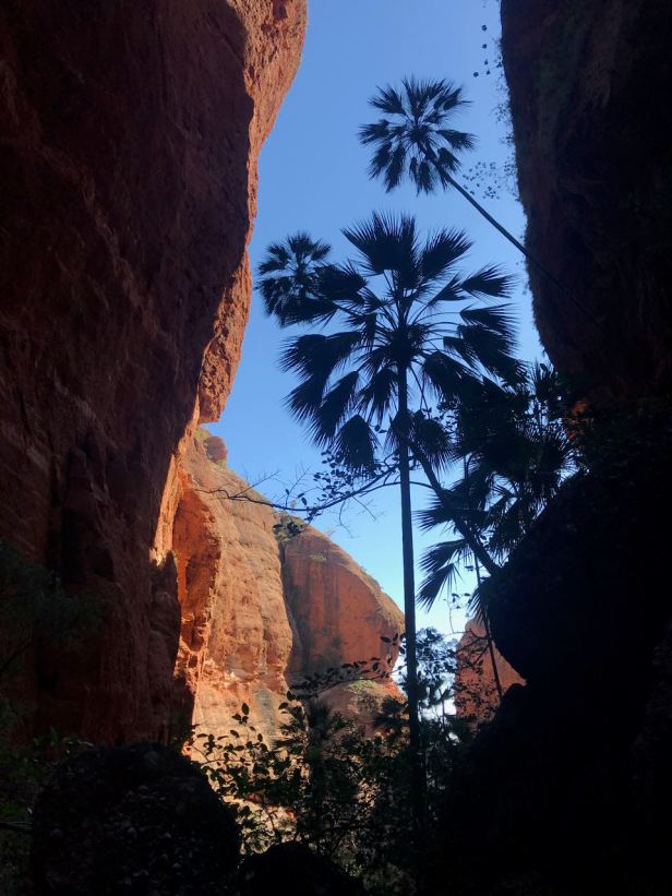
Mini Palms 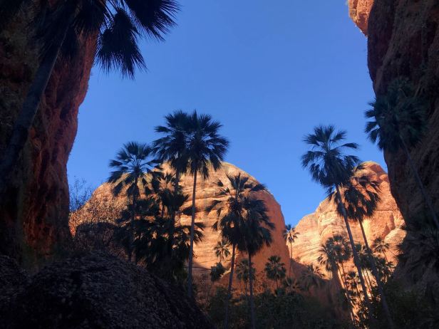
Sadly cane toads have arrived in Purnululu (and right over to Geikie Gorge further west) and we saw quite a few corpses of dead toads. Apparently crows can kill them but there has been a big toll on wildlife, the same as everywhere from the poison of the ingested toads.
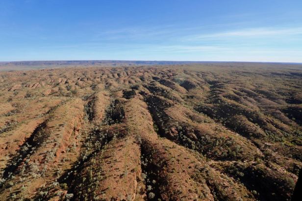
The finale for our visit was a 30 minute helicopter trip for an aerial view. It was great. Steve sitting in the co-pilot seat followed the super important safety briefing instruction not to touch the up/down controls next to his seat. Meanwhile, having never flown in a helicopter before, I was concerned I might not enjoy it. However, as soon as the earphones went on, blocking out the loud engine noise and rotor sound, it was fabulous. The ascent was smooth and vertical and all less physical and impacting than a plane take off. The trip was spectacular soaring over a series of gorges including Red Rock Gorge, Y Gorge and Deep Gorge, culminating in Piccaninny Gorge, the largest gorge in the massif and the iconic Domes, the beehive formations at the southern end.
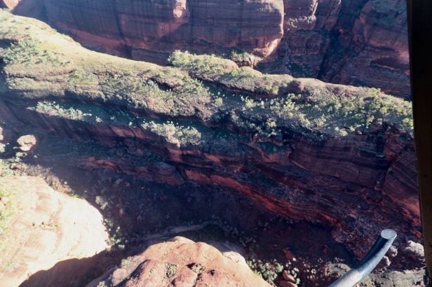
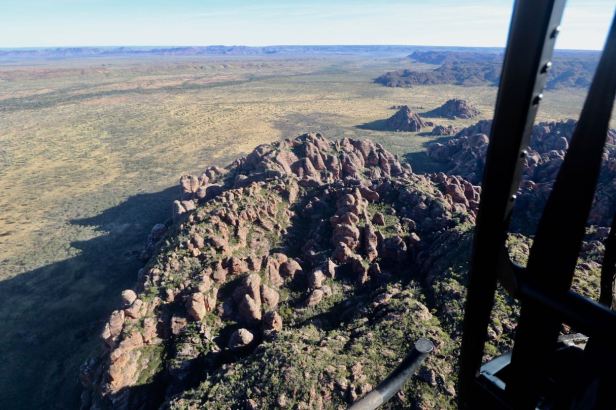
When viewed from the air, the top of the massif is relatively flat at the southern end while the north is more eroded with regular bumps, reflecting the fracture pattern.
Top of formation 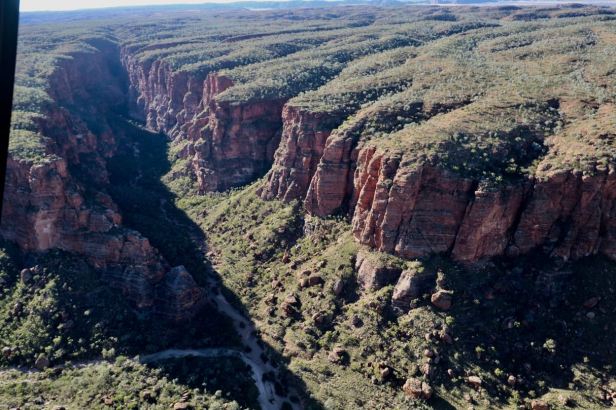
Piccaninny Gorge
People can go on independent hikes into Piccaninny Gorge but must be self-supporting and carry a locator beacon. We met a group with an average age of about 70 emerging from 6 days in the gorge when we walked in for our morning visit. They were a very robust group and the guy we spoke to said he’d tried to camp in the gorge 12 years ago later in the season but had been forced out after a couple of days as no water remained in the creek system. There was still water available at this point in the season.
From the helicopter the sand dunes of the Tanami Desert were visible in the distance. The adjacent Osmond Range to the north and Pernalulu with their seasonal rains and even some rainforest plants in the most sheltered gorges are an oasis in this region fringing the desert.
