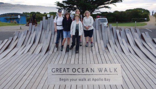
Apollo Bay, a couple of hours east of Melbourne is the starting point of the spectacular Great Ocean Walk (GOW). In subdued light (being 7.30am on Saturday of the last week of daylight saving), we met our tour organiser, Wilson at the appointed place.
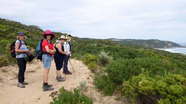
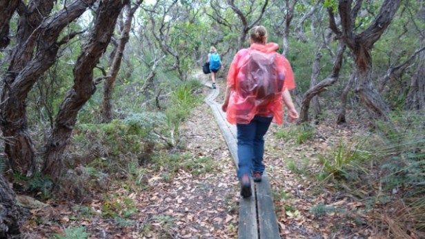
Over the next six days, he was our journey’s critical person. We carried day packs and walked at our own pace. Meanwhile, Wilson looked after our practical arrangements. He briefed us on our itinerary each day, provided food and drinking water, transferred our bags, set up arrangements for camping with our tents neatly erected, sleeping bags and clean sleeping sheets and pillows inside, issued maps, rain ponchos and emergency equipment …. We just walked.
For a group of women with family responsibilities, there was a particular pleasure in not thinking about food logistics for ourselves or anyone else for several days. We were issued with our individually packed breakfast options, tasty muesli, bananas, toast and hot drinks, the day food bag of a wrap or vege slice, fruit and day snacks, or dinner servings all neatly organized without any of us having to do anything. Dietary accommodations such as gluten free were catered for though we did heat our dinners and wash our own dishes
The joys of middle age revealed themselves early on. During preparations for the walk, there were multiple consultations with medical personnel. Problems included knees, toes, arches, feet joints, Achilles, asthma involving physiotherapists, podiatrists, doctors etc. …
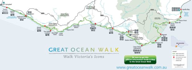
The GOW follows the coast from Apollo Bay to the Twelve Apostles 100km to the west. The route took us from the coast through the forests of Cape Otway and along the coastal reserves of Parks Victoria meandering around the landforms of the coast.
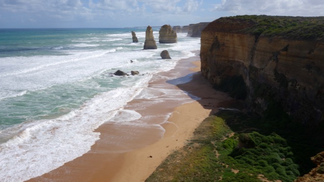
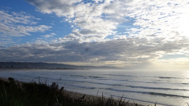
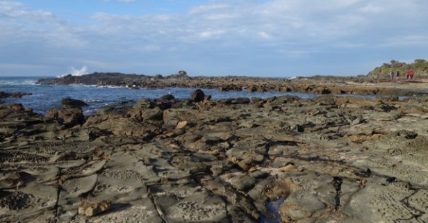
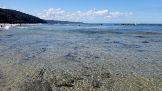
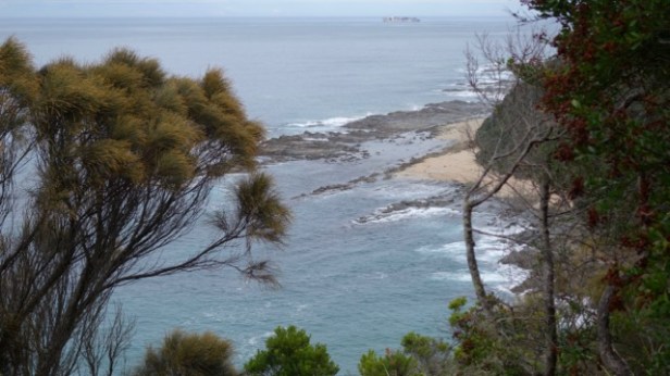
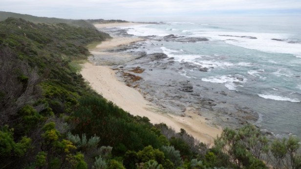
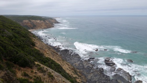
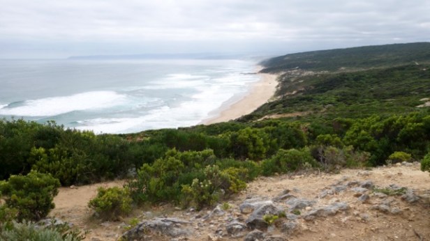
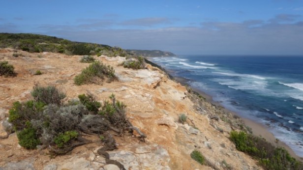
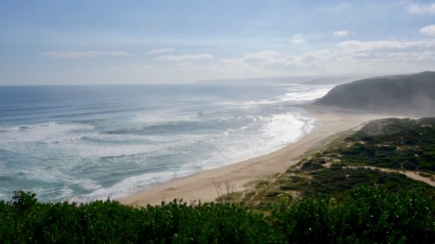
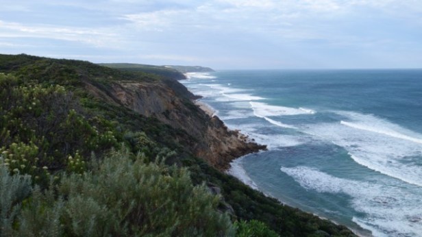
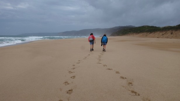
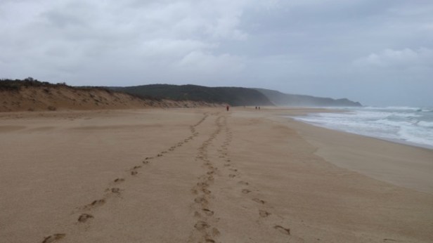
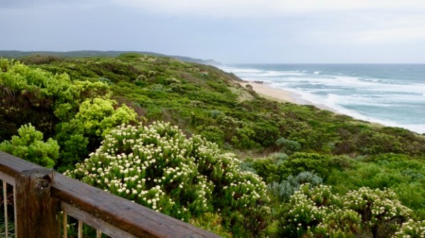
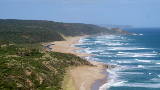
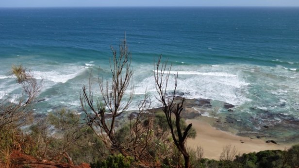
Sheer coastal bluffs diverted the path inland periodically through a range of forest communities and coastal heathlands. The path afforded spectacular views of the coast at times and diverted to the beach (as an option or by necessity) in several places. The tides and sea conditions were all-important for beach hiking, with soft sand a particular enemy. The sight and sound of the wild seas of Bass Strait and the Southern Ocean were the walk’s backdrop. Waves crashing over rocky formations and spectacular cliffs interspersed with sand beaches and rocky platforms jutting into the ocean characterized the coastline. The landscape was rugged and beautiful.
The coastline has a sad history as the resting place for many ships coming from Europe in the 19th century. The ‘Shipwreck Coast’ name for much of the coastline came about as vessels approached the narrow ‘Eye of the Needle’ passage between Cape Otway and King Island off Tasmania. The passage cut off six days of sailing time for vessels approaching Melbourne that would otherwise go around Tasmania. With its rocky coastline and tempestuous weather from the Southern Ocean, treacherous conditions brought about a tragic fate for many craft. These vessels were within a few days of their final destination after many difficult months at sea. Divers can see relics of lost vessels in many locations along the coast and remnants are also visible on-shore for walkers when conditions permit.
The GOW was also entirely separate to the Great Ocean Road. I had expected the walk to be in proximity to the road but was mistaken. It only joined the road at a few places. This famous Road was constructed as a public works project following the First World War to provide employment for former servicemen. The Great Ocean Road provided access for the remote settlements of the coast through difficult terrain. The roadway was hewn into cliffs rising high above the crashing waters below in many places and was a spectacular coastal drive to the east of Apollo Bay. Beyond Apollo Bay however, where the Great Ocean Walk begins, the road diverts kilometres inland through the hinterland forests due to the topography of the coast.
Day 1 – Apollo Bay – Blanket Bay
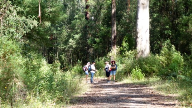
Leaving Apollo Bay upon issue of our Epirb, first aid kit, lunches and the ‘before’ photo, we walked along a road briefly before emerging on the foreshore.
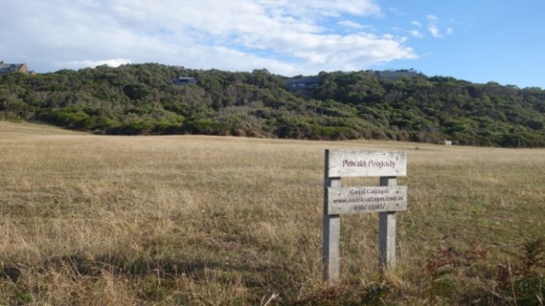
We passed a series of bays admiring homes nestled in the wooded hills. These homes had great views but would have been in peril in times of bushfires.
We soon encountered our first hill. It was all of 50m (doesn’t sound like much but vertically is like a 15 storey building) and we all thought it was pretty challenging.
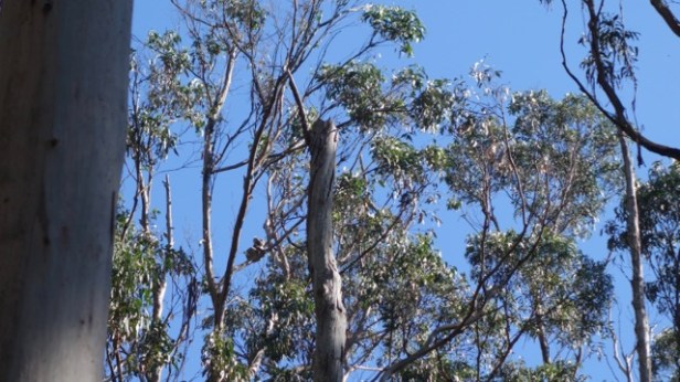
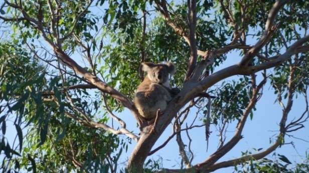
We paid a lot more attention to the profile illustrations on the map after this. Morning tea involved attractive views and rather sweet food offerings, (these grew on us over the following days). We were disappointed to see we had to go down and up much further – over 200m up to our lunch spot. Some invasive raspberries were seen on the way and were signed (we discovered later) as sprayed so just as well we didn’t sample these. Getting to the lunch stop was quite challenging. Some compensation was seeing our first koalas high in eucalypt forest along the way.
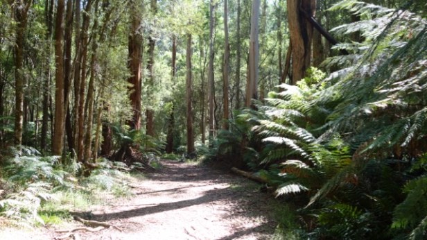
We were all foot sore and sorry for ourselves at lunch. The day had warmed up and become sunny with blue skies. Revived by tasty ham wraps, we stayed on former vehicle tracks in the forest for much of the rest of the day.
We had more distant koala sightings and the forest changed many times from gullies of treeferns and tall eucalypts through to more open vegetation with an under storey of lomandra or bracken ferns.
It was quite a slog being a 20km day and we missed the expansive ocean views from earlier in the day. We saw some English cyclists on a track on one section. Cycling looked hard.
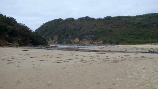
We finally got a view of the sea through the trees and descended to find Wilson and our camping site at Blanket Bay. The campground was a hive of activity accessible to car campers (presumably because it was the last weekend of daylight saving). There were people swimming, lying on the beach, kayaking and exploring the rock pools.
 Wilson took us up to the camping area and showed us our named tents with our gear inside (a sleeping bag, sleeping sheet and pillow). We had a very welcome cuppa and admired our surroundings.
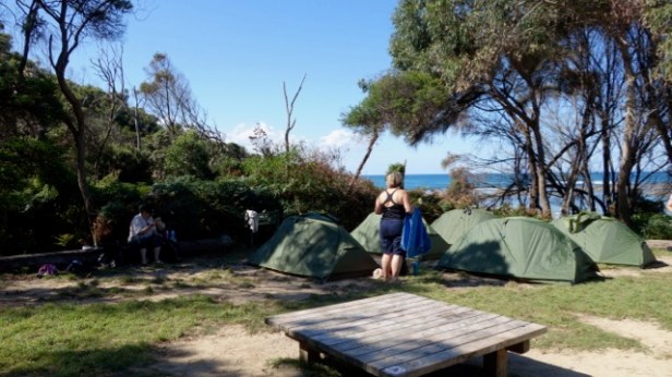
The swimmers included a guy in a wetsuit. The water very chilly and just right for reviving tired feet and two of our party braved a cleansing swim later on.
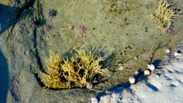
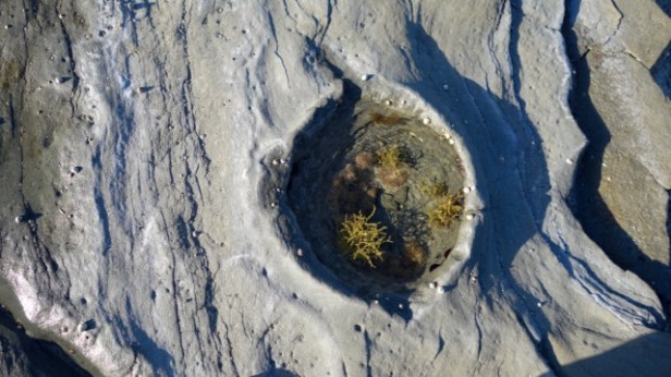
After a dinner of chicken korma, walking on the rocks in the twilight (it got dark after 7.30pm) small, brightly coloured starfish were visible in the rockpools.
Two resident campground koalas shuffled a few branches each over the course of the evening. The crashing of waves was the dominating sound for the day’s end and evening. It had been a very tiring first day.
Day 2 – Blanket Bay – Aire River Inlet
After a warm night, I woke up in the dark at 7am for a tasty breakfast of muesli, a banana and a couple of coffees. We got organized slowly packing up the roll mats, sleeping bags, pillows etc. trying to get them to fit into their respective bags (quite a Tetris challenge) and departed at 9. A family (with the mum toting a big backpack) and a solo walker Fiona, also being looked after by Wilson set off before us. We had a long day ahead of us of 22km.
A young female Spanish walker (Carla) pointed us in the right direction to exit the campground – a positive start! We showed her a koala subsequently, so returned her good turn. She walked with us for awhile and was from the Costa Brava. She had been learning English in Byron Bay and fruit picking close to Shepparton. She was very enterprising though had little food as she had expected towns on the walk like on the Camino walk in Spain! We walked through some beautiful forest of bracken ferns, Xanthorrhoeas, eucalypts, lomandras, coastal rosemaries, rushes etc. with the vegetation constantly changing.
Descending to Parker Inlet, two of our party showed their navigation skills walking straight across the waterway over rocks, while the rest of us were still scouting up and down the bank for a suitable place to cross.
 Many stairs (over 300) loomed ahead and Carla went on ahead of us here despite her carrying a sizable pack. We couldn’t keep her pace. She was hoping to do our 6 day walk in 4 days which was a big effort. We had morning tea overlooking Parker Inlet before continuing onto Cape Otway Lighthouse.
We saw some black cockatoos flying overhead over the narrow coastal national park reserve en route. Cleared farmland devoid of any native vegetation was visible in many places just beyond the fence line of the coastal reserves. These fragile narrow coastal reserves are critical for maintaining the connected habitat of the parks system for wildlife.
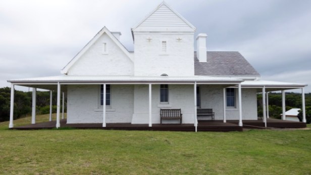
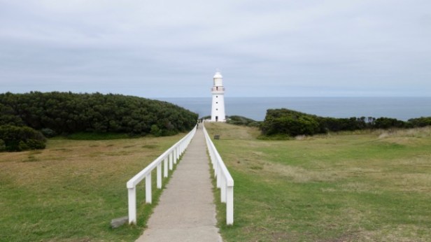
Cape Otway Lighthouse was our lunch spot where we used coupons issued by Wilson for lunch and entry (It was otherwise $19.50 entry). The café food options were wide ranging and my selection was a delicious steak sandwich and cappuccino. You could even have alcohol from the menu if you wanted. It was an excellent arrangement (and no wonder Wilson increased his prices this year). The family from Ballarat said their farewells to us here and the mother had carried the backpack successfully (there were some challenging climbs on the way, not to mention the 300 steps, so a great effort). We did our texting and so forth from the lighthouse as there was mobile reception. The lighthouse was fabulous with its winding steps, narrow balcony and staggering view.
Cape Otway was the place where the Southern Ocean and Bass Strait met and the northern side of the Eye of the Needle. On the lighthouse site, there was also a Telegraph Building, the Keepers cottages and a dinosaur exhibit relating to Dinosaur Cove (a few bays further on) where lots of footprints had been found linking to the time of connection of this area with the Antarctic continent, Gondwana. It was awesome.
We were a bit concerned about our timing for the afternoon as it was 1.30 when we set off and we still had 10.5km to go. We passed the lighthouse cemetery on the way with graves from the period of early occupation, including sadly, some of young children. We avoided the Station Beach walk that Wilson specifically told us not to take. A feature there, Rainbow Falls, apparently had been visited by a number of people and hadn’t even been recognized. It was an area of seepage on the cliff face. It was probably easier to appreciate from a long distance looking darker than the other areas of the cliff face – ‘a colourful spring-fed algae-covered cliff.’ It was at one end of the beach and involved a difficult walk on soft sand. The Spanish gal with the backpack travelling on her own did the beach walk, mind you, and she arrived at the campground well in advance of us.
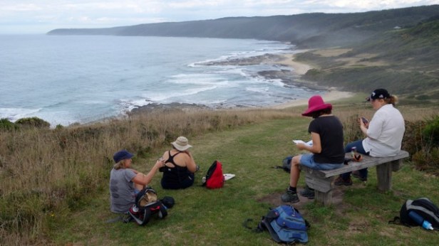
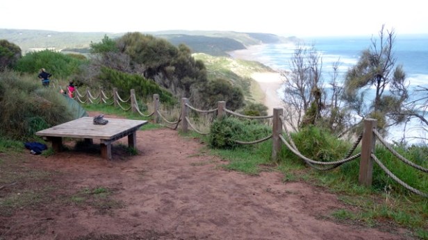
We hoped she’d managed to buy some provisions at the lighthouse. We had an afternoon break at what we thought was Escarpment Lookout but wasn’t (it was a bit further on and much less spacious for our purposes) which involved lounging around and admiring the view. 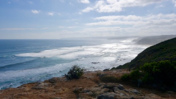
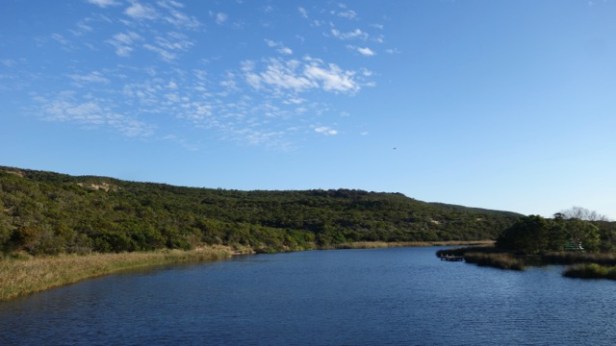
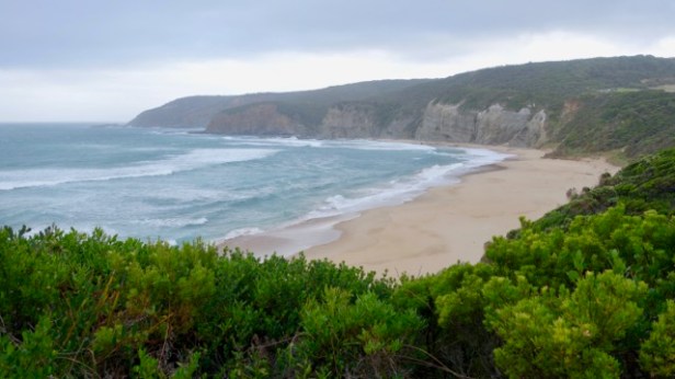
 There were beautiful views along the coast and into the Aire River inlet with its campground, bridge and reed fringed lake beyond.
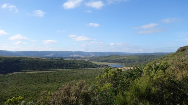
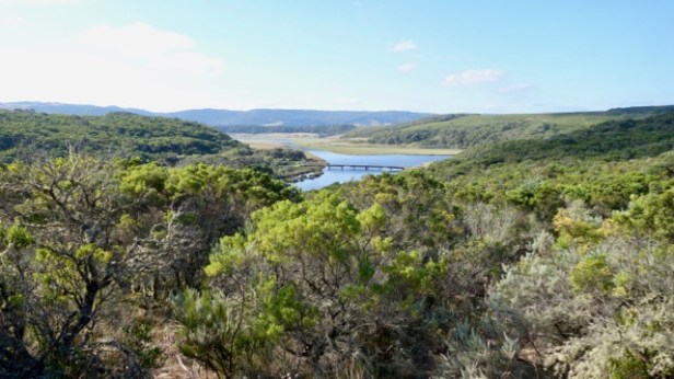
We finally arrived at the Aire River Camping area with its idyllic meadow setting, a picturesque bridge, wooden landing, a small bathing area and green lawn areas for camping. Carla and Fiona were sitting on the bridge chatting, looking very relaxed in this pastoral scene as our disheveled group emerged from our day’s labours. We unfortunately had to walk up lots of steps straight up the hill at the end of the day past the toilet to the GOW group camping space. The upward ascent was very unwelcome. The campground was a beautiful setting but the toilet way below the group area, inconvenient. There were two koalas peacefully eating nearby in the campground trees including one just near the toilet. These koalas were the closest we managed to get to these beautiful animals.
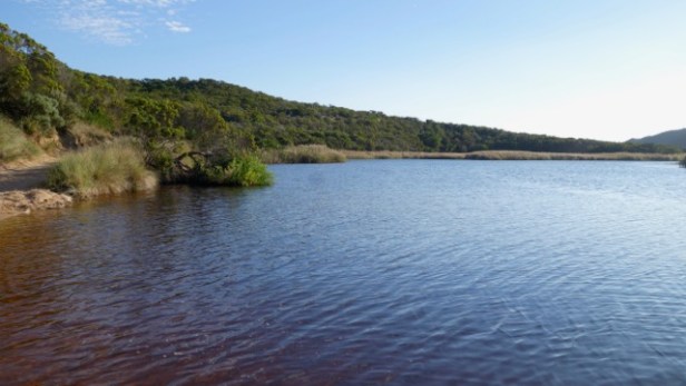
 Susan and Tracey went for a bathe down in the river – Kathy went down afterwards too. We were all so hot – with the water very tea tree coloured – I put my feet in and had little fish swimming over them. It was an arduous afternoon.
Wilson left us on our own for the night so we had to fend for ourselves. We felt a bit bereft. Fortunately Jenny and Fiona (who inspired much confidence) had carefully listened to the instructions about using the cooker and heating our food. Overcoming our sense of abandonment, we heated up our dinner (sweet potato and chicken with pasta), washed-up, cleaned-up etc. We used my mother-in-law’s clothes line for the wet swimmers in the shelter as the condensation on the tents was very heavy in the early evening. There were also lots of small black millipedes in the camping area which were a bit freaky getting on the inside mesh of the tent, plus inside occasionally. These were not good to camp with. There was lots of rustling, snoring etc. from the group as we were away from the background noise of the ocean. Going outside in the night, a discreet bush visit was a better prospect than the long walk down the stairs to the toilets, though the stars were amazingly bright.
Day 3 Aire River Inlet – Johanna Beach
Next morning, we climbed on leaving the campground returning to the coast.
We passed Castle Cove Lookout where the Great Ocean Road met the GOW track briefly. There were a number of day visitors around this area along with a mess of toilet paper. No toilets were provided there. The provision of these would be my suggestion for the Parks authority given clearly a lot of people visit this site and seek a toilet stop. It was an unpleasant contrast to the excellent standard of track construction, signage and maintenance elsewhere.
Two female Singaporean walkers caught up to us after the lookout and we saw a couple of small snakes along the path including one with a white colouring on its head (a white-lipped snake). 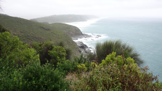
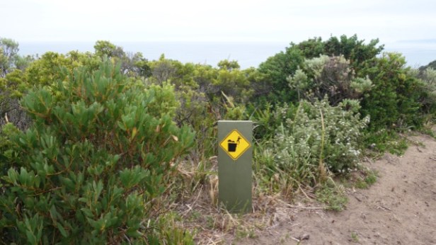
We continued onward climbing up to an old quarry where boot washing was required (for cinnamon fungus) from a brushing device, with a dip of disinfectant in the middle. We eventually mastered the use of the devices but perhaps Wilson needed to brief people on these.
The weather was starting to look really threatening at this point. An initial shower passed to be followed by more significant rain as we descended to Johanna Beach. Tracey retrieved Fiona’s hat on the path, dropped while donning wet weather gear. We had been hoping to find somewhere to stop to eat but nothing presented itself before the beach as the wind and rain had really started by then. We were kitted up with our rain gear but inevitably got soaked and chilled being blasted by the strong headwinds toiling up 2km of beach. There wasn’t any better alternative, so on we went.
 \
\
The sand fortunately wasn’t too soft as the tide had recently gone out so at least we weren’t sinking too badly into the beach. It was wild conditions and felt like something from ‘The Piano’. We all straggled up the beach in our lightweight brightly coloured ponchos or coats and shorts or wet pants. Kathy and my plastic pants dried out substantially as we walked up the beach in the stiff wind in a pause in the rain.
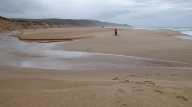
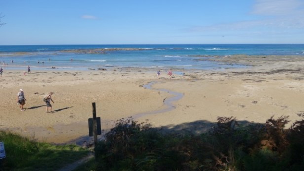
We then came across the Johanna River beach crossing which we could fortunately jump over rather than wade. Having to take our shoes off would have been such a pain. The crossing conditions depend on the tides.
We found the exit from the beach after a bit of confusion with the map and got to a lovely park shelter, toilet block and lunch spot at Johanna Carpark.
We were joined by the Singaporean girls (they were bigger budget GOW folk staying at B&B’s – hot baths, …) for lunch (‘I’m with Telstra’ was a classic quote about national phone coverage from the more gregarious Singaporean) and there was a Cairns terrier and a light coloured Labrador playing around. It was a beautiful lawn setting. We all got chilled sitting in our damp gear so put on whatever extra clothing was available. A note from the Spanish lady was found in the table (amazing) after a guy told us about it as we were leaving (she’d dropped her coat with her mobile phone in the pocket). It stopped raining and we went on the path up to the GOW Campground seeing some Gang Gang cockatoos on the way.
Wilson and Fiona and the Spanish lady’s coat awaited us. It was the most spectacular setting for a campground, set high on the cliffs looking up a long stretch of coast with the beach far below. The afternoon became bright and clear with little wind, such a contrast to our cyclonic conditions battling up Johanna Beach.
A school group eventually arrived that were sleeping out in the open under tarps. It was much more pleasant to be protected from the creepie crawlies inside our tent cocoons.
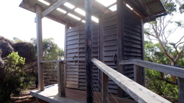
The campground had a great toilet block with driftwood timber door handles and constructed of hand milled timber weatherboards with irregularities continuing between the boards. A fantastic view was afforded from a glass window out over a pastoral scene below.
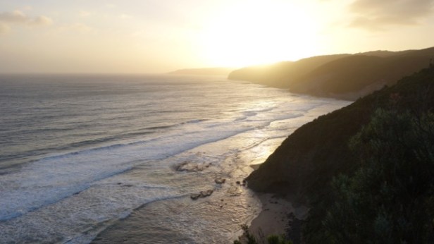
We walked up in the twilight to a viewpoint on the cliffs seeing kangaroos and the sunset. It was a beautiful spot. We were also asked to downsize our kit and pack up into a smaller bag in the morning for the last three days, as Wilson had to wheel in our things by wheelbarrow to the last two camping sites…
